A disaster “the size of multiple Katrinas” is brewing off Washington’s coast.
“Katrina,” of course, is the Category 5 hurricane that leveled New Orleans in 2005, killing nearly 1,400 people.
The lurking monster in the Pacific Northwest is the Cascadia Subduction Zone, where undersea and continental tectonic plates collide. Over the last 10,000 years, it has spawned at least 40 earthquakes, “nearly all in the 8.2 to 9.2 magnitude range,” the most recent one in January 1700.
Such a quake would lift the ground 30 feet and send a 60-foot wall of water surging over the coastline.
Washington’s Department of Emergency Management estimates more than 160,000 people live in areas that would be inundated. At risk greatest risk are residents of Grays Harbor and Pacific counties, low-lying flat terrain with no high ground nearby.
If it happens, it will be the worst natural disaster in U.S. history. It’s practically a given that many residents and tourists won’t escape, because they’ll have only 60 minutes or so to reach higher ground, and roads will be impassable, so they’ll have to do it on foot.
If you’re near the water when the ground starts shaking heavily, that’s the warning to run like hell. Read story here.
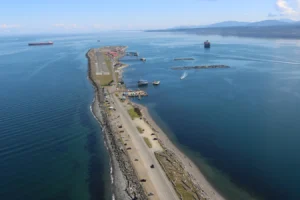
Photo: Ediz Hook, near Port Angeles, is where you don’t want to be for the Big One
